Background of Using Urban Rainy Season Waterlogging Monitoring Stations
The rainy season in cities is a period with a high incidence of waterlogging disasters. Weather conditions such as short-term heavy rainfall and continuous precipitation can easily exceed the carrying capacity of urban drainage systems, leading to rapid water accumulation in low-lying road sections, underground passages, residential areas and other regions. Waterlogging not only causes traffic paralysis and affects citizens´ travel efficiency, but also may submerge vehicles, soak houses and even threaten people´s lives. At the same time, it damages urban infrastructure systems such as power, communication and water supply, triggering a series of chain problems.
Traditional waterlogging monitoring mostly relies on manual inspections and public feedback. This method not only results in delayed information acquisition, making it difficult to grasp the dynamic changes of accumulated water in real time, but also leads to inaccurate judgment of key data such as the depth and scope of accumulated water. As a result, flood control command departments cannot formulate effective response strategies in a timely manner, and emergency disposal work is often in a passive state. In addition, different urban areas have differences in drainage capacity and topographic characteristics, leading to uneven distribution of waterlogging risks. Traditional monitoring methods are difficult to achieve accurate coverage and dynamic tracking of key waterlogging-prone points. To monitor the water accumulation situation in various urban areas in real time and accurately during the rainy season, quickly warn of waterlogging risks, provide a scientific basis for flood control decision-making, emergency dispatch and public evacuation, and minimize losses caused by waterlogging, urban rainy season waterlogging monitoring stations have emerged as an important technical support for improving the urban flood control and emergency response capacity during the rainy season.
Product Introduction
The urban waterlogging underground water accumulation monitoring system is a system that comprehensively utilizes computer network technology, database technology, communication technology, new sensing technology and other technologies. Supported by the Internet of Things (IoT) technology, it integrates "energy-saving perception and intelligent service" to build an intelligent monitoring system. It improves the regulation and control capacity and provides technical means for safeguarding people´s lives and property safety.
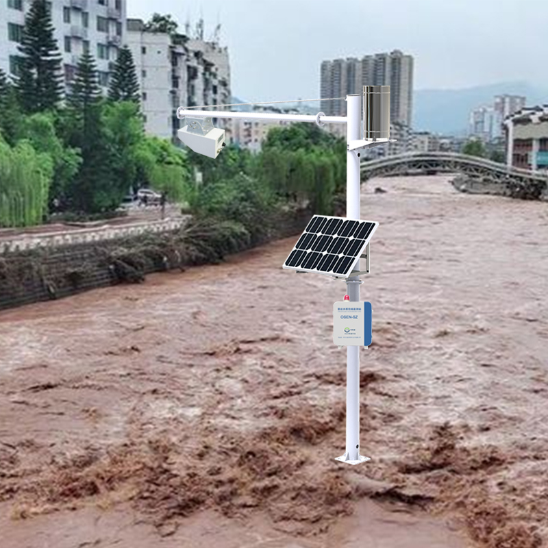
The system consists of an underground water accumulation monitoring main station, LORA underground water accumulation monitoring points and an integrated environmental monitoring cloud platform. It mainly provides real-time monitoring and early warning services for waterlogging-prone locations such as urban roads, ground surfaces, tunnels and overpasses. The system adopts a highly integrated, all-in-one water accumulation monitoring station, which monitors the water level in low-lying road sections across the urban area in real time and realizes automatic alarm. By integrating data from various monitoring points, it grasps the overall waterlogging situation in the urban area and conducts drainage dispatch in a timely manner. With the help of this system, municipal management departments can carry out regular monitoring, early warning and early preparation, take corresponding measures for areas that may suffer from floods due to heavy rains, reduce the probability of urban waterlogging, and at the same time issue early warnings to residents in areas where water levels are rising.
Traffic management departments can obtain real-time water levels on various road sections through this system, and provide travel guidance to the general public via media such as radio and television, preventing people and vehicles from entering deep-water road sections by mistake, reducing the economic losses of the public and ensuring their personal safety. The system is very simple in construction and deployment, with thoughtful details and convenient expansion. It uses LORA signal transmission to send the collected water level signals to the environmental monitoring cloud platform, which has no distance limitation and avoids the trouble of laying lines. The monitoring and management platform is also very user-friendly, with an intuitive interface, simple operation and comprehensive functions.
System Advantages
The core sensors of the monitoring equipment are all high-precision sensors, with a wide measurement range and high accuracy, ensuring the product has excellent reliability, high precision and stability.
The urban waterlogging underground water accumulation monitoring system supports multi-platform remote management, allowing data viewing and remote management through multiple methods such as computer web terminals, mobile phone APPs, WeChat mini-programs and WeChat official accounts.
The system has a wide range of applications. It can not only be used in rivers, irrigation systems and underground drainage pipe networks to provide data support for urban drainage work, but also in low-lying road intersections, underpasses, overpasses, bridge holes and tunnels to ensure people´s travel safety. In addition, it can be used in underground garages to prevent flood disasters, protect people´s property safety and safeguard social and economic benefits.
It adopts high-performance industrial-grade LoRa transmission terminals, which use LoRa networks to provide users with wireless data transmission functions. With an embedded real-time operating system as the software support platform, it adopts a low-power design, supports multi-level sleep and wake-up modes, and minimizes power consumption.
It can conduct wireless long-distance communication with 32 underground water accumulation monitoring points within the effective communication distance at the same time. In terms of communication, it avoids mutual interference between end nodes during signal transmission, and also solves the problems of short communication distance and insufficient penetration of traditional wireless devices, realizing the compatibility of low power consumption and long distance.
It supports the setting of exceedance thresholds and intelligent linkage. Based on urban waterlogging and flood control parameters, it can predict the arrival of waterlogging and flood situations in advance, link with on-site LEDs and alarm lights to provide safety travel reminders, and can also link with on-site drainage equipment to start timely drainage, avoiding or delaying the occurrence of urban waterlogging.
It has a weather forecast function, which can display real-time weather forecast information according to the specific urban location. The system supports real-time device positioning, allowing users to view the installation location of each monitoring point on the GIS map of the cloud platform. When data is abnormal or exceeds the limit, it can display an alarm, facilitating the quick identification of abnormal devices for timely handling and convenient later maintenance and management.