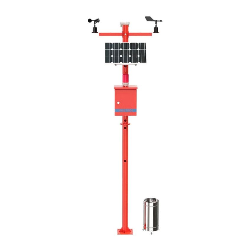
Product overview
Front-end monitoring system with thermal imaging binocular ball camera to base station near several kilometers forest video monitoring image acquisition, realize comprehensive monitoring, through the digital yuntai ranging function azimuth and pitch Angle and telephoto lens focal length to realize the precise automatic positioning, realize the intelligent identification of fire point, once found suspicious, back-end monitoring (command) center will immediately send an alarm signal and locate the ignition point on the GIS map display.
major function
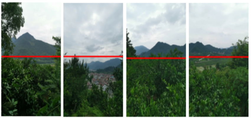
Forest fire monitoring and early warning: remote thermal imaging is set up in the commanding heights of fire watchtowers in the forest area to cover the initial fire situation, timely detection, timely alarm, timely rescue, so that the fire hazard dies in the bud.
Fire point positioning: the system is based on the front-end digital cloud head information and its altitude, tower height, Yuntai horizontal angle and pitch angle information combined with DEM data, After discovering a fire based on the automatic identification and alarm function of forest fire, System can quickly and accurately lock the fire position, At the same time to get the small place name of the fire point, Automatic calculation of the dangerous equipment and facilities around the fire point, fighting force (forest fire prevention professional team, semi-professional team, township fire fighting emergency team, etc.), And quickly analyze and calculate the nearest / best path of each fighting force to the fire site, Dynamic simulation of forest fire fighting, Make the fire fighting command personnel nearby organization of fire fighting team, materials to carry out effective fighting. The system uses a single monitoring tower to achieve positioning. According to the DEM data, the monitoring tower height, the horizontal Angle and pitch Angle of the camera (lens), and calculate the intersection point between the camera and the ground.
Double spectral detection: using visible light and infrared thermal imaging technology, can overcome the haze weather on the influence of visible camera imaging, and infrared camera occlusion resistance is poor, image is not intuitive single intelligent recognition system shortcomings, improve the ability of forest fire intelligent recognition, throughout the year, all-weather efficient intelligent recognition warning. During the system detection, infrared thermal imaging is used for comprehensive scanning. When a suspected fire is detected, it can be identified twice through visible pictures to improve the alarm accuracy and missing report.
Technical parameter table
Using a 1 / 1.8 " inch high-performance sensor, clear image, visible light maximum resolution of 26881520
6-240mm40 x optical zoom, 16 x digital zoom
Support automatic aperture, automatic focus, automatic white balance, backlight compensation, digital width dynamic, 3D digital noise reduction, day and night conversion
Support laser light filling, an effective distance of 800mSupport polygon privacy shading, multi-region can be set, multi-color optional
Support fog transmission, strong light suppression, electronic anti-shake, SmartIR anti-infrared overexposure technology
ROI region of interest for enhanced encoding
Support intelligent wiper function (single, automatic, cycle, etc.)
Resolution 384288, high sensitivity detector, support for contrast regulation
Support the intelligent fire spot detection function
Support the abnormal temperature alarm function
Supports shutter correction in timing, temperature difference and manual mode, AGC mode
Support 3D noise reduction function, 15 kinds of pseudo-color adjustable, image detail enhancement function
Support mirror, local video output; thermal imaging lens 25mm, maximum 8 x digital doubling
application scenarios
Applied to forest and grassland fire warning and fire monitoring and other scenarios