If there is continuous or heavy rainfall during the flood season, cities are prone to waterlogging. Data shows that on average, more than 180 cities in China are affected by waterlogging every year. Overpass bridge openings, subways, underground pedestrian walkways, underground shopping malls, and underground garages are all high-risk areas for waterlogging. Therefore, it is very important to use waterlogging monitoring stations to monitor real-time changes in water levels at flood prone points.
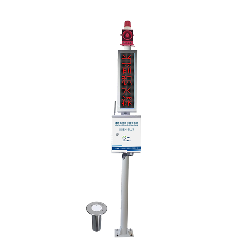
The OSEN-BLJS waterlogging monitoring system adopts a highly integrated equipment waterlogging monitoring station to monitor the waterlogging level of each low-lying road section in Shuangcheng District in real time and achieve automatic alarm. By integrating data from various monitoring points, the waterlogging situation of the entire urban area is grasped, and timely drainage adjustment is carried out. With the help of this system, the municipal administration departments can achieve regular monitoring, early warning and early preparation, deal with the places where floods may occur due to rainstorm, reduce the probability of urban salvage, and at the same time, do a good job of early warning for the people in the areas where water level rises. The traffic management department can obtain real-time water levels of various road sections through this system, and provide travel guides for the general public through media such as radio and television, avoiding personnel and vehicles from entering deep water sections, reducing economic losses for the public, and ensuring their personal safety.
Product advantages
1. The core sensors of the monitoring equipment all use high-precision sensors, with a wide measurement range and high accuracy, ensuring that the product has excellent reliability, high precision, and stability.
2. Multi platform remote management is supported. The urban waterlogging underground water logging monitoring system supports data viewing and remote management in a variety of ways, such as computer webpage, mobile APP, WeChat applet, WeChat official account, etc.
2. The system has a wide range of applications, and can be used to provide data support for urban drainage work in rivers, irrigation, underground drainage pipeline networks, etc. It can also be used in low-lying intersections, underpasses, overpasses, bridge openings, tunnels, and other places to ensure people´s travel safety; It can also be used for underground parking garages to prevent flood disasters, protect people´s property safety, and ensure social and economic benefits.
4. Adopting high-performance industrial grade LoRa transmission terminals, utilizing LoRa network to provide wireless data transmission function for users, using embedded real-time operating system as software support platform, low-power design, supporting multi-level sleep and wake-up modes, and minimizing power consumption.
5. It can simultaneously conduct wireless long-distance communication with 32 buried water accumulation measurement points within the effective communication distance range, avoiding mutual interference between endpoint nodes during signal transmission, and avoiding the problems of short communication transmission distance and insufficient penetration of traditional wireless devices, achieving compatibility between low power consumption and long-distance.
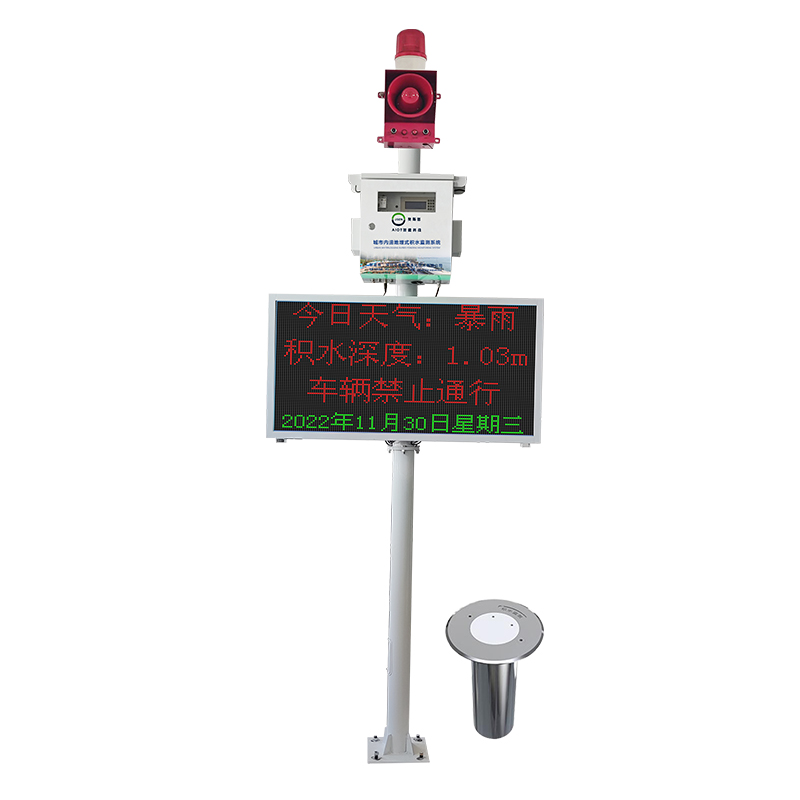
6. Support setting exceeding threshold and intelligent linkage. By using urban flood control parameters, it is possible to predict the arrival of flood conditions in advance, link on-site LED and alarm lights for safe travel reminders, and link on-site drainage equipment to start timely drainage, avoiding and delaying the occurrence of urban flooding.
7. The weather forecast function can display real-time weather forecast information based on specific city locations.
8. The system supports real-time device positioning and can view the installation location of each monitoring point in the GIS map of the cloud platform. When the data is abnormal or exceeds the limit, an alarm can be displayed, making it easy to quickly identify abnormal devices and handle them in a timely manner for later maintenance and management.
Keyword: